All functions are not working, still under construction. Please be patient. Thank you

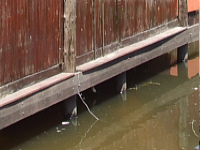
Katima Mulilo's Water Tower (where NamWater, the country's Water Supplier, pumps the town's water from) has a measuring plate on the wall, where they - and residents that would like to know - can check the levels of the river. They also work with satellite images and information from the water stations in Zambia and can predict watermass coming down within 12 hours of heavy rain in the catchment areas.
The measuring scale works in correct and true meter unites. In the low season of the river (October - December) the level of the river can even show in negatives on this plate!
When water masses comes down, it's not like the other (dry) rivers in Namibia where you can see the wave coming down. Because the Zambezi is a constant flowing river, surges are seen in 3-4 day sharp increases before the measurement starts going up/down normally agian.
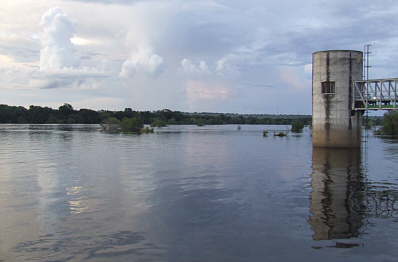
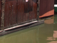
The water can rise quite fast, as these 2 photos taken in 2008 at Mukusi River Lodge, which is just 200m away from the Water Tower, shows.
The measuring scale works in correct and true meter unites. In the low season of the river (October - December) the level of the river can even show in negatives on this plate!
When water masses comes down, it's not like the other (dry) rivers in Namibia where you can see the wave coming down. Because the Zambezi is a constant flowing river, surges are seen in 3-4 day sharp increases before the measurement starts going up/down normally agian.
The water can rise quite fast, as these 2 photos taken in 2008 at Mukusi River Lodge, which is just 200m away from the Water Tower, shows.
20 February 2008
20 February 2008
22 February 2008
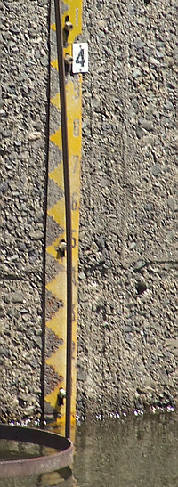
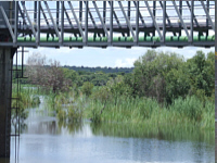
7 February 2009 3m
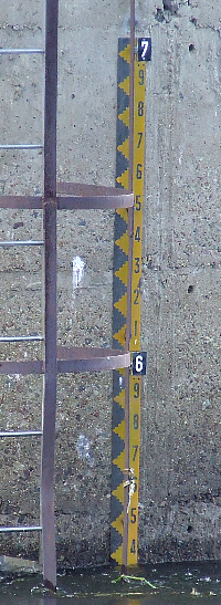
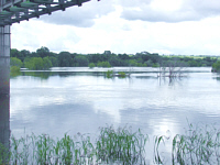
28 February 2009: 5,35m
Readings taken on Saturday 7 February 2009 at 14H00 and again
on 28 February 2009 at 14H00: 3 weeks later and 2,35m higher,
which gives an average rising of the river at about 11.2 cm per day.
on 28 February 2009 at 14H00: 3 weeks later and 2,35m higher,
which gives an average rising of the river at about 11.2 cm per day.
Here is how the landscape from under the bridge changed in this 3 weeks. Remembering that this happens annually, people are still amazed at how the trees and vegetation survive and regrow for the next season. The photos were taken at the same time as the above photos.